Hunger Insecurity in Your District
Food Insecurity Stats
For the first time ever, the Food Bank surpassed 40 million pounds of food distributed in a single year. That’s a 2.3% increase over last year.
Right now, 1 in 3 Californians are experiencing or are at risk of poverty-related hunger, and nearly 5.4 million residents rely on CalFresh to put food on the table. With rising costs of living, inflation, and the passage of H.R. 1, the One Big Beautiful Bill, we anticipate that the demand for our services will only increase further.
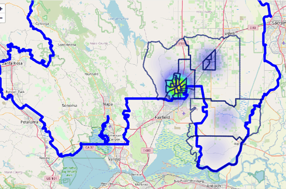
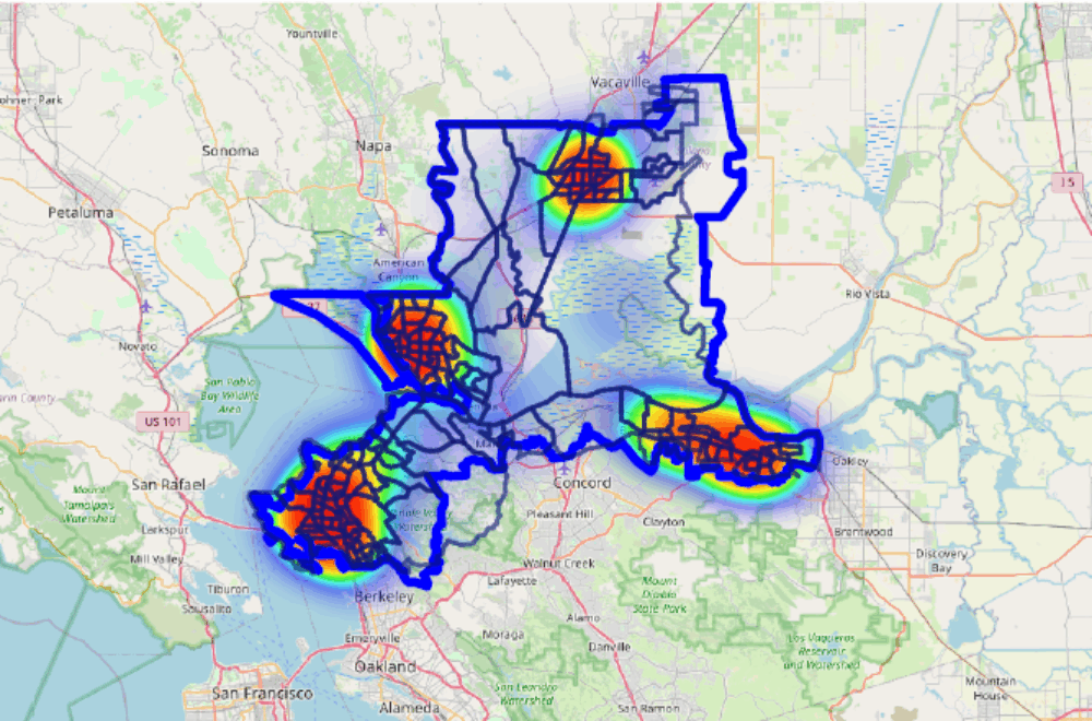
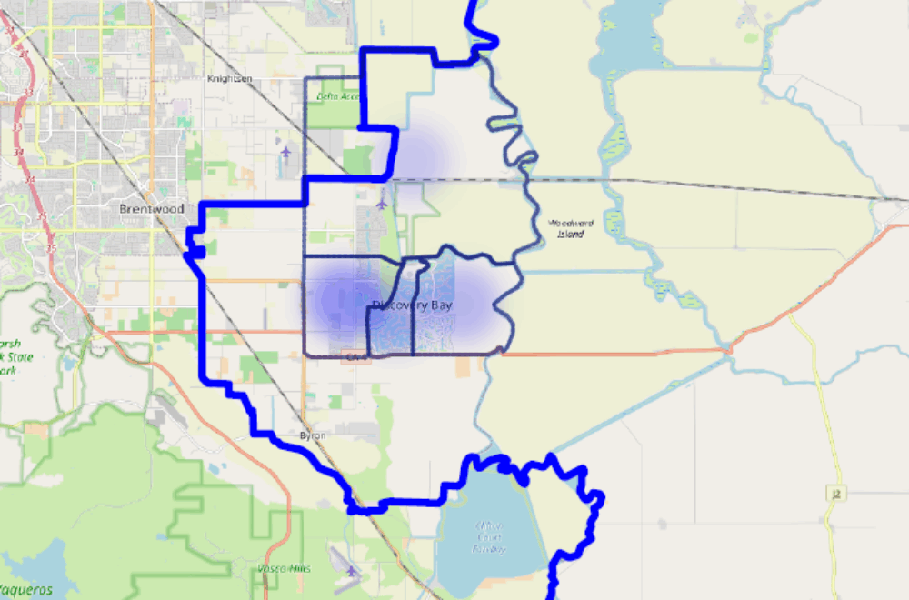
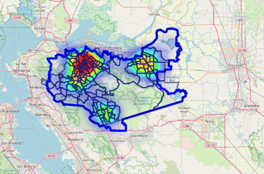
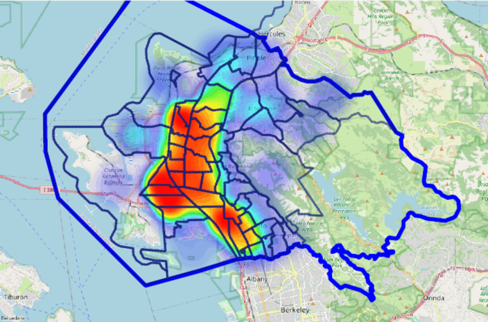
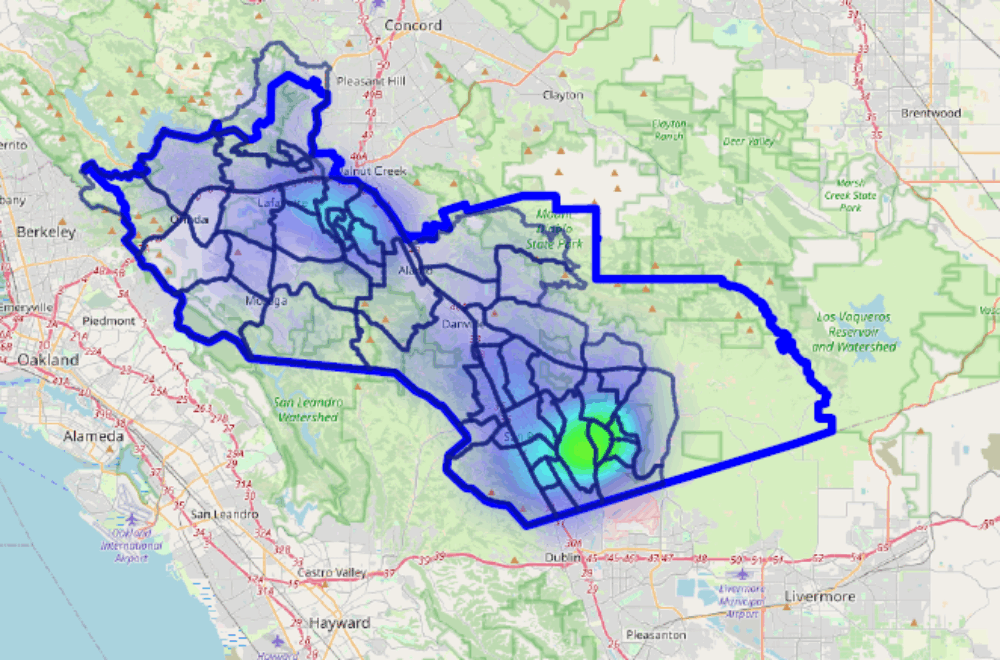
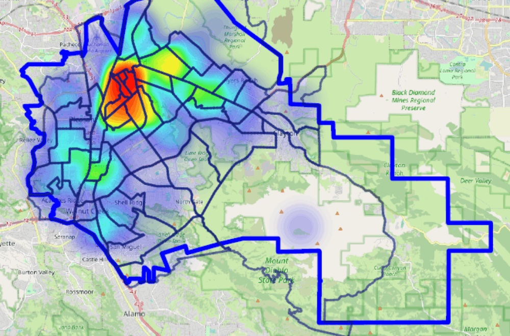
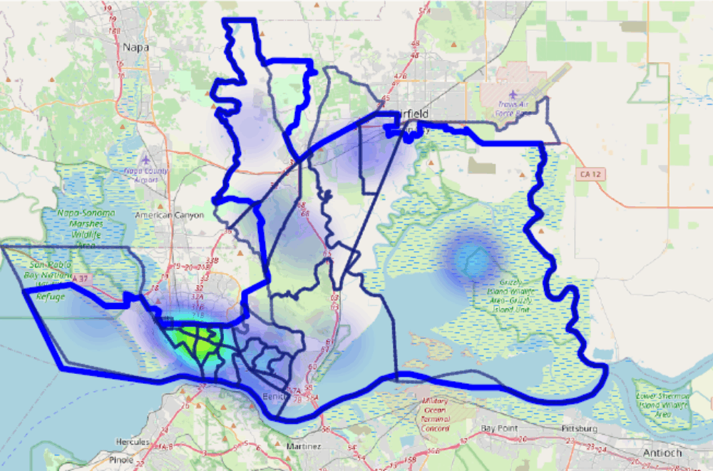
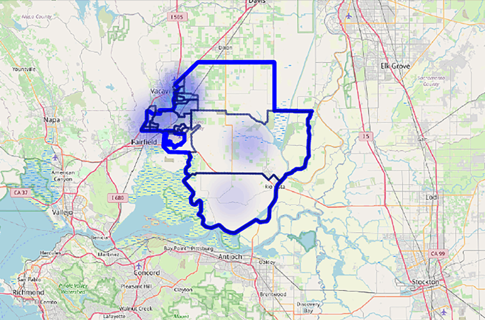
As a result, the Food Bank has developed food security heat maps to identify gaps in service areas and expand outreach to underserved communities. These maps show poverty rates, food insecurity rates, where hunger is most present in your district, and more!
Congressional Districts
The district is located in the northwestern part of the state, and includes parts of Solano County. Major cities in the district include Woodland, Vacaville, and more.
The 8th district includes parts of Contra Costa and Solano Counties, including the cities of Vallejo, Fairfield, Richmond, and parts of Martinez.
The district includes portions of Contra Costa County, including cities such as Oakley, Discovery Bay, and more.
This district includes the cities of Concord, Walnut Creek, Danville, San Ramon, Brentwood, and southern Antioch.
Contra Costa County Supervisor Districts
Bayview, East Richmond Heights, El Sobrante, Kensington, Montalvin Manor, North Richmond, Rollingwood, Tara Hills
Alamo, Blackhawk, Camino Tassajara, Canyon, Castle Hill, Diablo, Norris Canyon, Reliez Valley (partial), Saranap/Parkmead
Antioch, Oakley, Brentwood, Discovery Bay, Byron, Bethel Island, and Knightsen
Acalanes Ridge, Contra Costa Centre, North Gate, Reliez Valley (partial), San
Miguel, Shell Ridge
Alhambra Valley, Bay Point, Briones, Clyde, Crockett, Mountain View, Pacheco,
Port Costa, Reliez Valley (partial), Rodeo, Vine Hill